
THEIA-MTD
The geospatial data center of THEIA-MTD delivers remote sensing based products over France Mainland and southern countries (e.g. Guyana). Its main research thematics are Forest, Soil, and Agricultural crops. We are part of the Data-Terra initiative.
Cloud native 🚀
Find and manipulate geospatial data on the fly without downloading anything.
OGC Compliant
Compliant with the Open Geospatial Consortium standards.
Secure 🛡️
Compliant with authentication system of Data-Terra.
Featured pages
Thematics
Description of MTD Theia thematics
Technology
Description of Montpellier's Theia center used technologies
Use the QGIS STAC browser plug-in
Tutorial to use the QGIS STAC browser plug-in with our solution
Services overview
Overview of the different geospatial services deployed in the data center

Our SDK 🔧
Our Software Development Kit (SDK) provide a smooth way of interacting in Python or R with our APIs
Upload your geospatial products in the data center
The theia_dumper CLI tool enables to upload STAC collections on our data center.
Latest posts
Fordead
by Jean-Baptiste Feret
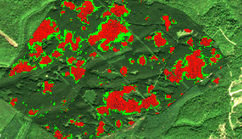
Package to address the bark beetle health crisis on spruce trees in France
Building footprints
by Rémi Cresson
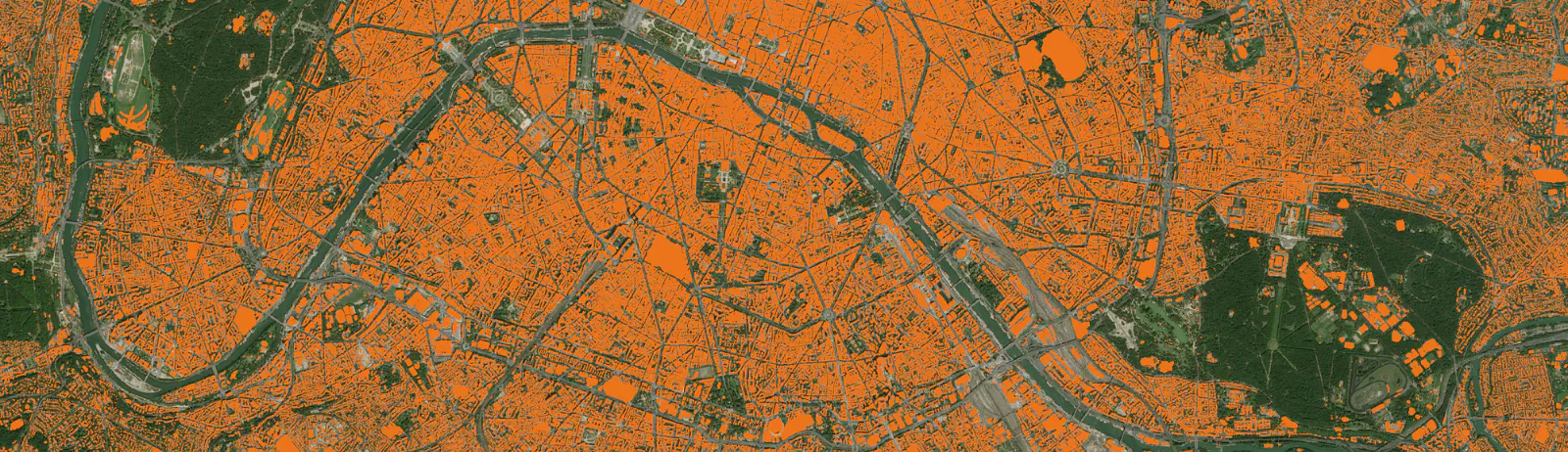
Building footprint map generated each year from Spot-6/7 images using deep learning
Soil moisture at very high resolution
by Nicolas Baghdadi
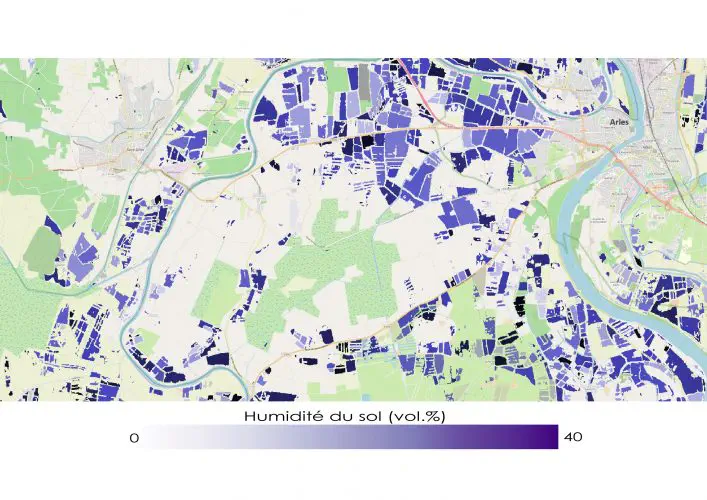
Retrieving soil moisture from physical model inversion of SAR images.